Tumuruu BESS & Solar

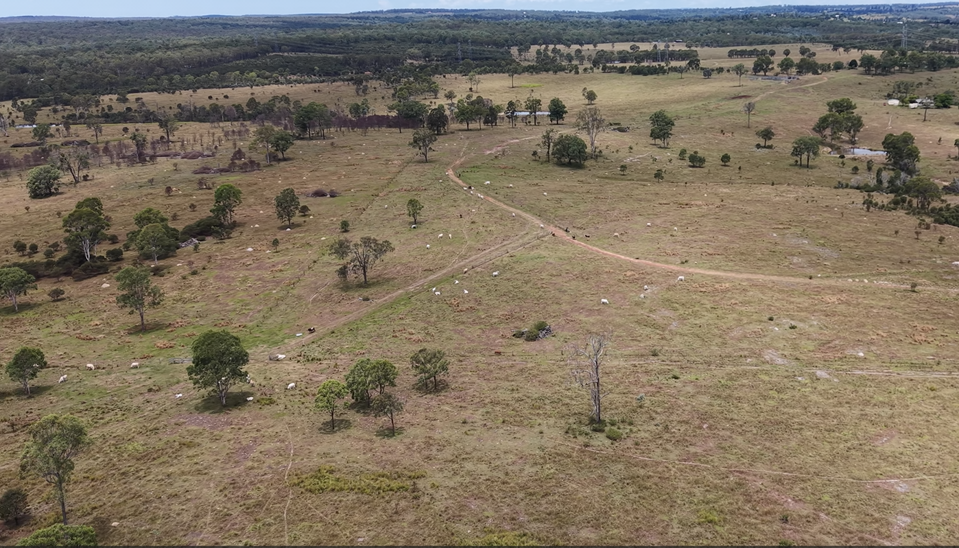
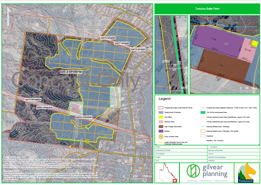
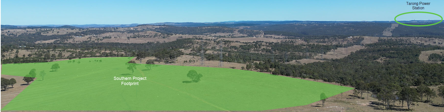
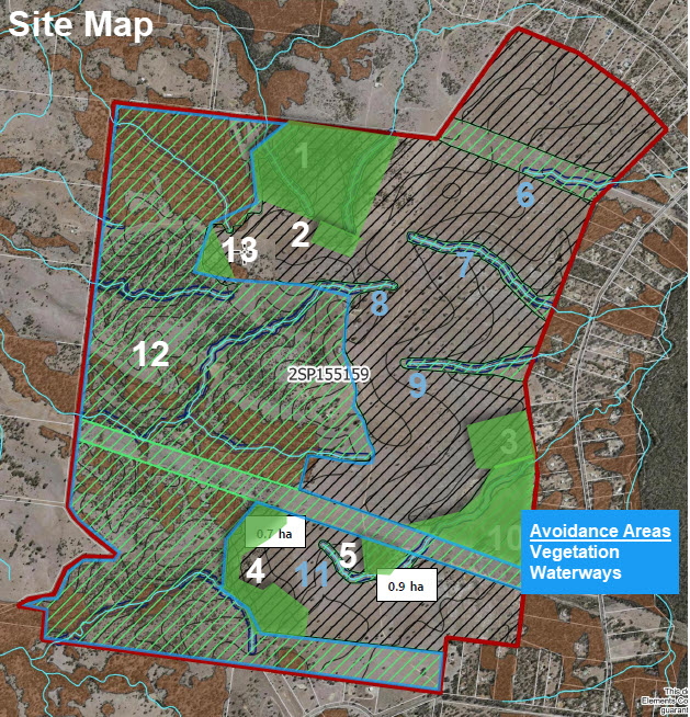
The Tumuruu BESS & Solar is a large-scale renewable energy project located at 341 Bowman Road, Taromeo. The project site sits on approximately 672 hectares of freehold land with the project footprint covering approximately 300 hectares.

Designed to deliver a 400MW grid connection with 2,000MWh of battery energy storage system (BESS) plus up to 400MW of solar PV, Tumuruu will provide enough dispatchable green energy to supply over 125,000 households.

The project is being developed by Australian Solar Enterprises with support from a highly qualified and experienced group of consulting partners with a combined 110+ years in development approvals and the renewables industry.

Aerial view of the Tumuruu project site

World-Class Design

Tumuruu uses a low-profile, high-density solar solution that minimises visual impact and preserves the agricultural character of the land.

📏

Ultra-Low Profile

A compact substructure reaching approximately one metre at its highest point, dramatically reducing visual impact compared to conventional solar installations and sitting well below typical fence-line height.

🌍

72% Less CO2

The innovative substructure design produces 72% less carbon dioxide during manufacturing and installation compared to conventional solar mounting structures, contributing to a lower lifecycle carbon footprint.

🚚

40% Faster Delivery

The lightweight design reduces supply chain requirements, logistics complexity, and installation time by up to 40%, meaning less disruption during the construction phase for the local community.

The Project Site

The site is situated at 341 Bowman Road, Taromeo, in Queensland's South Burnett region, just north of the town of Blackbutt. It benefits from proximity to existing Powerlink high-voltage transmission infrastructure.

  • Approximately 672 hectares of freehold land
  • Project footprint covering approximately 300 hectares
  • Previously cleared land classified as Class C agricultural
  • Adjacent to existing high-voltage transmission lines
  • Remaining land continues to support agricultural use
  • Dense 15-metre native vegetation buffers planned where required
Tumuruu site layout plan
Panoramic view of the southern project footprint showing onsite powerlines and retained native vegetation, with Tarong Power Station visible in the distance

Southern project footprint looking south-west, showing existing Powerlink transmission lines crossing the site and native vegetation corridors being retained. Tarong Power Station is visible in the distance to the west.

Sensitive Site Design

The project layout has been carefully designed to avoid and retain areas of environmental significance, with solar infrastructure sited only on previously cleared, low-value agricultural land.

Avoidance & Retention Strategy

The site design reflects a deliberate avoidance-first approach. Rather than clearing vegetation and managing offsets, the project has been configured to work around areas of ecological value, retaining them in place as permanent corridors and buffers.

🌳
Mapped & Unmapped Vegetation

Areas of mapped remnant and regrowth vegetation, as well as unmapped native vegetation identified through on-ground surveys, have been excluded from the development footprint and retained in situ.

💧
Waterway Corridors

East-west waterway corridors that cross the site have been preserved as continuous green corridors, maintaining natural drainage paths and providing ecological connectivity across the project area.

🐚
Wildlife Connectivity

Retained vegetation along the western boundary and through the waterway corridors creates connected habitat pathways, supporting movement of native fauna including koalas and other species identified in ecological assessments.

🌱
Vegetation Buffers

Dense 15-metre native vegetation buffers are planned around the project perimeter where required, reducing visual impact for neighbouring properties and enhancing ecological value at the site boundary.

Tumuruu site avoidance map showing vegetation retention areas, waterway corridors, and numbered development zones

Site avoidance map showing retained vegetation (green), waterway corridors (blue), and development zones. Click to enlarge.

The result: of the approximately 672-hectare site, only around 300 hectares will be developed for solar and battery infrastructure. The remaining land — over half the total site area — is retained for native vegetation, waterway corridors, ecological connectivity, agricultural use, and perimeter buffers.

2,000 MWh Battery Storage

The significant battery energy storage component is what makes Tumuruu truly different. While solar generation is inherently variable, the 2,000MWh BESS allows energy to be stored during peak generation and dispatched into the National Electricity Market when demand is highest.

This means Tumuruu doesn't just generate green energy — it delivers it reliably, on demand, when the grid and consumers need it most. This dispatchability is critical for grid stability as Australia transitions toward its climate targets.

400MW

Grid connection capacity ensuring maximum export capability into the NEM

2,000MWh

Battery energy storage system providing dispatchable power around the clock

125,000+

Households equivalent of green energy generation capacity

Project Timeline

Key phases from approvals through to first production.

2024
2025
2026
2027
2028
👥 Approvals
💰 Final Investment Decision
🚧 Project Construction
First Production

Have Questions About the Project?

We welcome enquiries from the community, stakeholders, and industry partners.